- Define drainage, drainage basin, watershed and catchment area, and tell a river basin apart from a watershed
- Identify a drainage pattern (dendritic, radial, trellis or centripetal) from its description
- Explain why the book classifies Indian rivers into Himalayan and Peninsular drainage, and how each group formed
- Trace the source, course and tributaries of the Indus, Ganga and Brahmaputra
- Name and locate the seven major Peninsular rivers with their key facts
- Discuss why India floods and faces drought at the same time, and what is being done about river pollution
1 Drainage Basics
The flow of water through well-defined channels is called drainage, and the network of such channels is a drainage system. Its pattern depends on the geological time period, the nature and structure of rocks, topography, slope, the amount of water flowing, and how often it flows.
The area from which a river collects its water is its catchment area. That same area, drained by a river and its tributaries together, is called a drainage basin: the catchments of large rivers are called river basins, while those of small rivulets and rills are usually called watersheds (so a basin is simply a large watershed).
The boundary line separating one drainage basin from another is the watershed (also called the water divide). Basins and watersheds show unity: a change in one part affects the whole, so they make good micro, meso or macro planning units.
1.1 The four drainage patterns
“Radial” and “centripetal” are opposites and are a favourite MCQ pair: radial rivers move away from a central point (like spokes), centripetal rivers move towards one (like water down a funnel).
2 Classifying the Indian Drainage System
The book groups Indian rivers on three different bases. Only the third is the classification the rest of this chapter follows.
2.1 By discharge into the sea
| Group | Share of drainage area | Main rivers |
|---|---|---|
| Bay of Bengal drainage | ≈77% | Ganga, Brahmaputra, Mahanadi, Krishna, etc. |
| Arabian Sea drainage | ≈23% | Indus, Narmada, Tapi, Mahi, Periyar |
The two groups are separated by the Delhi ridge, the Aravalis and the Sahyadris, together forming the main water divide of India.
2.2 By size of the watershed
| Category | Catchment area | Number of basins | Examples |
|---|---|---|---|
| Major river basins | > 20,000 sq km | 14 | Ganga, Brahmaputra, Krishna, Tapi, Narmada, Mahi, Pennar, Sabarmati, Barak |
| Medium river basins | 2,000-20,000 sq km | 44 | Kalindi, Periyar, Meghna |
| Minor river basins | < 2,000 sq km | many small ones | Rivers of low-rainfall areas |
2.3 By mode of origin: the scheme this book uses
Himalayan drainage
- Fed by melting snow AND rain, so perennial
- Young, still-evolving valleys with deep gorges
- Highly tortuous in the hills, meanders once on the plains
- Ganga, Indus and Brahmaputra basins
Peninsular drainage
- Fed mainly by rain, so many are non-perennial
- Old, mature, broad and shallow graded valleys
- Fixed course, no meandering (except Narmada and Tapi)
- Mahanadi, Godavari, Krishna, Kaveri basins
This is the book’s own chosen scheme, but the book admits it is imperfect: the Chambal, the Betwa and the Son rise in the northern Peninsula yet are grouped with the Himalayan (Ganga) system because of how they are classified here, though they are actually older in age and origin than the true Himalayan rivers.
3 Evolution of the Himalayan Drainage
4 River Systems of the Himalayan Drainage
4.1 The Indus system
One of the world’s largest river basins. It rises near Bokhar Chu (31°15′N, 81°40′E) in the Kailash range of Tibet, at 4,164 m, called Singi Khamban (“Lion’s mouth”) there. It flows northwest between the Ladakh and Zaskar ranges, cuts a spectacular gorge near Gilgit, enters Pakistan near Chilas (the Dardistan region), and finally meets the Arabian Sea east of Karachi. In India it flows through the Union Territories of Ladakh and Jammu & Kashmir.
An antecedent river is one that is older than the mountain range it crosses: it already had its course before the Himalayas rose, and cut deep gorges to keep that course as the mountains lifted around it. The Satluj, the Subansiri and the Kosi are all antecedent rivers.
| Tributary | Rises at / near | Notable point |
|---|---|---|
| Jhelum | Verinag spring, foot of Pir Panjal, Kashmir valley | Through Srinagar and the Wular lake; joins Chenab near Jhang (Pakistan) |
| Chenab | Chandra + Bhaga streams join at Tandi, near Keylong (HP) | Largest Indus tributary; also called Chandrabhaga; 1,180 km before Pakistan |
| Ravi | West of Rohtang pass, Kullu hills (HP) | Through the Chamba valley; joins Chenab near Sarai Sidhu |
| Beas | Beas Kund, near Rohtang Pass (4,000 m) | Through the Kullu valley; meets the Satluj at Harike |
| Satluj | Raksas Tal, near Mansarovar, Tibet (4,555 m) | Tibetan name Langchen Khambab; antecedent river; feeds the Bhakra Nangal canal system |
These five rivers together are called the Panjnad (“five rivers”), joining the Indus a little above Mithankot. Other Himalayan tributaries of the Indus itself: the Shyok, Gilgit, Zaskar, Hunza, Nubra, Shigar, Gasting and Dras. The Kabul river joins on the right bank near Attock; the Khurram, Tochi, Gomal, Viboa and Sangar (all from the Sulaiman ranges) join further south.
4.2 The Ganga system
India’s most important river, both for the size of its basin and for its cultural significance: the largest river system in India.
| Fact | Detail |
|---|---|
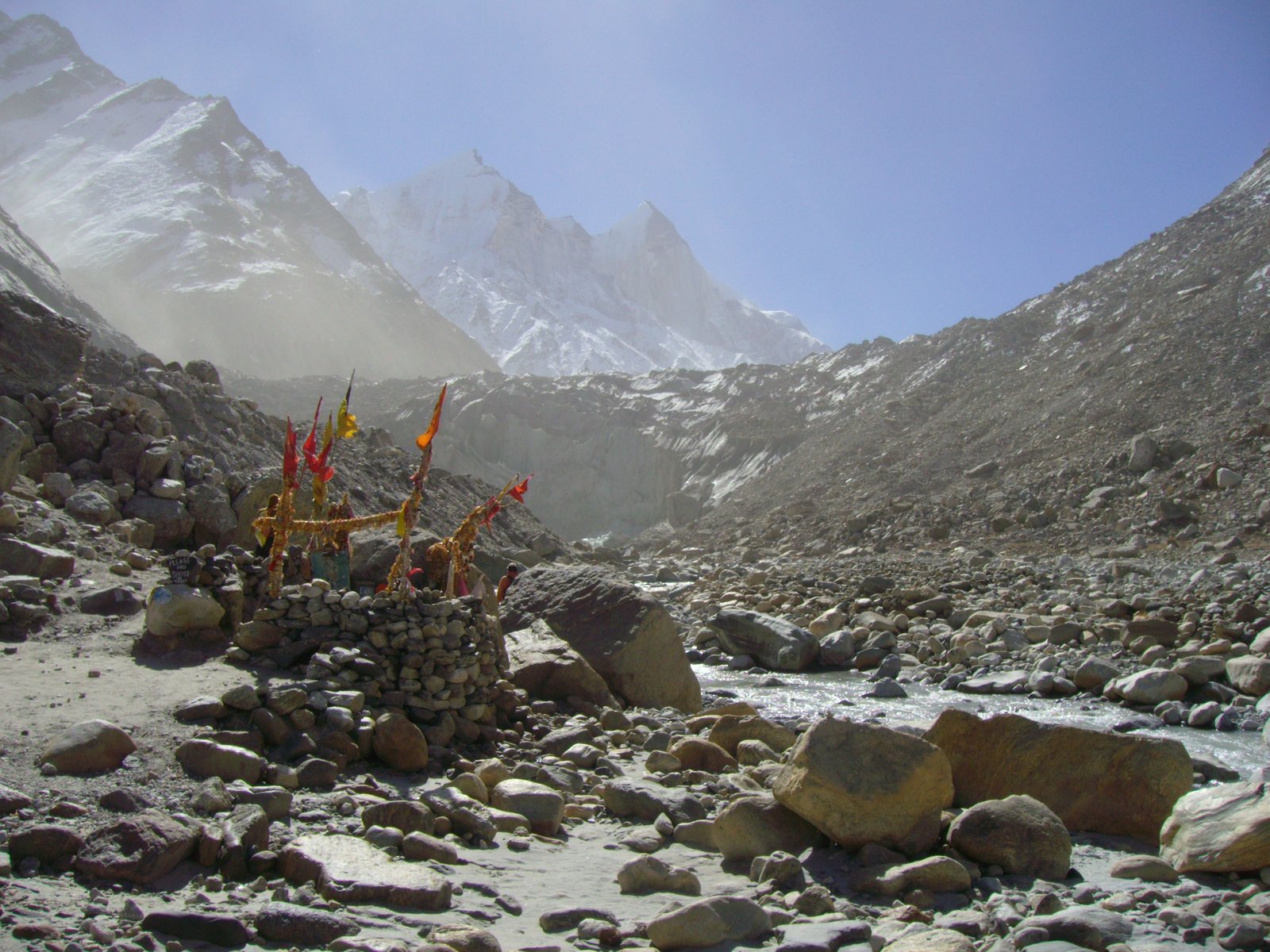
| Source | Gangotri glacier, at Gaumukh (3,900 m), Uttarkashi district, Uttarakhand, called the Bhagirathi up to Devprayag |
| Devprayag | Bhagirathi meets the Alaknanda (from the Satopanth glacier above Badrinath), from here it is called the Ganga |
| Alaknanda’s own tributaries | Dhauli + Vishnu Ganga meet at Joshimath (Vishnu Prayag); Pindar joins at Karna Prayag; Mandakini joins at Rudra Prayag |
| Enters the plains | At Haridwar |
| Length / basin | 2,525 km; basin ≈8.6 lakh sq km in India |
| Length by state | Uttarakhand 110 km · Uttar Pradesh 1,450 km · Bihar 445 km · West Bengal 520 km |
| Mouth | Splits into the Bhagirathi and the Padma distributaries; reaches the Bay of Bengal near Sagar Island |
| Tributary | Bank | Key fact |
|---|---|---|
| Son | Right (major) | Rises on the Amarkantak plateau; forms waterfalls; joins near Arrah, west of Patna |
| Yamuna | N/A | Westernmost and longest Ganga tributary; source: Yamunotri glacier, Banderpunch range (6,316 m); joins the Ganga at Prayag (Allahabad) |
| Chambal, Sind, Betwa, Ken | Yamuna’s right bank | All rise on the Peninsular plateau; Chambal rises near Mhow (Malwa plateau), passes the Gandhisagar dam, and is famous for the Chambal ravines (badland topography) |
| Hindan, Rind, Sengar, Varuna | Yamuna’s left bank | Smaller left-bank tributaries of the Yamuna |
| Gandak | Left | Formed by the Kaligandak and Trishulganga in Nepal; enters Bihar at Champaran; joins Ganga at Sonpur |
| Ghaghara | Left | From the Mapchachungo glaciers; the Sarda joins it in the plains; meets Ganga at Chhapra |
| Kosi | Left | Antecedent river; main stream Arun (north of Everest, Tibet); Son Kosi + Tamur Kosi join it to form the Sapt Kosi; called the “Sorrow of Bihar” for constantly shifting course under its own silt load |
| Ramganga | Left | Small river from the Garhwal hills near Gairsain; joins Ganga near Kannauj |
| Mahananda | Left (last) | From the Darjiling hills; last left-bank tributary, in West Bengal |
| Sarda (Saryu) | N/A | From the Milam glacier (called Goriganga there); Kali/Chauk on the Indo-Nepal border; joins the Ghaghara |
| Damodar | N/A | Eastern margin of the Chotanagpur Plateau, in a rift valley; joins the Hugli; main tributary the Barakar; once the “Sorrow of Bengal”, now tamed by the Damodar Valley Corporation |
Approved in June 2014 as a Flagship Programme, with the twin goals of stopping pollution and reviving the Ganga. Its main pillars: Sewerage Treatment Infrastructure, River-Front Development, River-Surface Cleaning, Bio-Diversity, Afforestation, Public Awareness, Industrial Effluent Monitoring, and Ganga Gram.
4.3 The Brahmaputra system
| Fact | Detail |
|---|---|
| Source | Chemayungdung glacier, Kailash range, near Mansarovar lake, Tibet |
| In Tibet | Flows ≈1,200 km east through dry, flat southern Tibet as the Tsangpo (means “the purifier”); the Rango Tsangpo is its major right-bank tributary there |
| Gorge | Carves a deep gorge near Namcha Barwa (7,755 m) in the Central Himalayas; emerges as the Siang (or Dihang) |
| Enters India | West of Sadiya, Arunachal Pradesh; after the Dibang (Sikang) and Lohit join on the left bank, it is called the Brahmaputra |
| Through Assam | 750 km; left bank: Burhi Dihing, Dhansari (South); right bank: Subansiri (antecedent, from Tibet), Kameng, Manas, Sankosh |
| Enters Bangladesh | Near Dhubri; the Tista joins on the right bank and it becomes the Jamuna; merges with the Padma before reaching the Bay of Bengal |
The Brahmaputra is famous for floods, channel shifting and bank erosion, because most of its tributaries are large and bring huge sediment loads from a heavy-rainfall catchment. Don’t confuse this with the Kosi’s “Sorrow of Bihar” reputation: the cause (heavy tributary sediment) is similar, but they are different rivers in different states.
5 The Peninsular Drainage System
Older than the Himalayan drainage, shown by its broad, largely-graded, shallow valleys and matured rivers.
5.1 How it evolved: three geological events
Subsidence of the western flank
In the early Tertiary period, the western flank of the Peninsula subsided below the sea, disturbing the once-symmetrical drainage on either side of the original water divide.
Himalayan upheaval
The northern flank of the Peninsular block subsided and trough-faulted. The Narmada and the Tapi now flow in these trough faults, filling the cracks with their own sediment, which is why they lack alluvial and deltaic deposits.
Slight tilting, northwest to southeast
This tilt gave the whole Peninsular drainage system its orientation towards the Bay of Bengal.
5.2 General character
The Western Ghats act as the main water divide for Peninsular rivers: most major rivers flow west to east into the Bay of Bengal, while short rivulets on the seaward side run into the Arabian Sea. Peninsular rivers keep a fixed course, do not meander, and are mostly non-perennial; the Narmada and the Tapi, flowing through rift valleys, are the two exceptions.
Note: the Chambal, the Sind, the Betwa, the Ken and the Son also rise in the northern Peninsula, but the book places them in the Ganga system (Section 4.2), not among the Peninsular river systems below.
5.3 The seven major Peninsular rivers
| River | Source | Length | Catchment | Mouth / notable point |
|---|---|---|---|---|
| Mahanadi | Sihawa, Raipur district, Chhattisgarh | 851 km | 1.42 lakh sq km (MP+Chhattisgarh 53%, Odisha 47%) | Bay of Bengal, through Odisha; some navigation in lower course |
| Godavari | Nasik district, Maharashtra | 1,465 km | 3.13 lakh sq km, largest Peninsular river system | Called “Dakshin Ganga”; delta after Rajamundri; heavy floods near Polavaram; tributaries Penganga, Indravati, Pranhita, Manjra |
| Krishna | Mahabaleshwar, Sahyadri | 1,401 km | Maharashtra 27%, Karnataka 44%, AP+Telangana 29% | 2nd largest east-flowing Peninsular river; tributaries Koyna, Tungabhadra, Bhima |
| Kaveri | Brahmagiri hills (1,341 m), Karnataka | 800 km | 81,155 sq km (Kerala 3%, Karnataka 41%, Tamil Nadu 56%) | Perennial, fed by both SW and NE monsoons; tributaries Kabini, Bhavani, Amravati |
| Narmada | Amarkantak plateau (≈1,057 m) | 1,312 km | 98,796 sq km | Rift valley between Satpura and Vindhyan range; Dhuandhar waterfall near Jabalpur; 27-km estuary into the Arabian Sea south of Bharuch; Sardar Sarovar Project |
| Tapi | Multai, Betul district, MP | 724 km | 65,145 sq km (Maharashtra 79%, MP 15%, Gujarat 6%) | Other major west-flowing river; flows in a rift valley like the Narmada |
| Luni | Two branches (Saraswati + Sabarmati) join at Govindgarh, near Pushkar | N/A | Largest river system of Rajasthan, west of the Aravalis | Ephemeral throughout; flows to the Rann of Kuchchh |
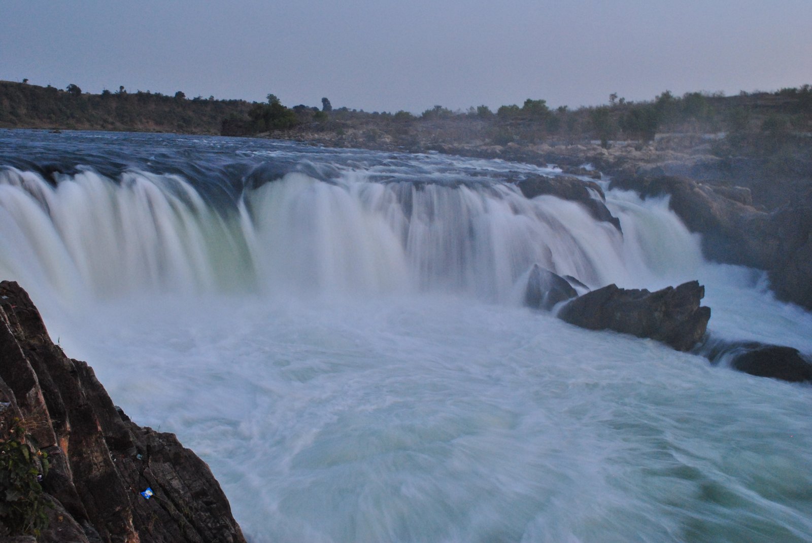
A delta is the fan-shaped landform a river builds at its mouth by depositing sediment and splitting into several distributaries; it forms where the sea’s tidal action is too weak to carry the sediment away (e.g. the Ganga-Brahmaputra delta, the Godavari delta). An estuary is a funnel-shaped river mouth where fresh water mixes with the sea, formed where a strong tide keeps clearing the sediment away instead of letting it settle; the Narmada and the Tapi both end in estuaries, not deltas.
6 Using and Protecting India’s River Water
India’s rivers carry a huge volume of water every year, but it is spread very unevenly across time and space: some regions flood while others face drought at the very same time, because most rainy-season water simply runs off to the sea instead of being stored.
6.1 Perennial vs non-perennial rivers
Perennial rivers
- Carry water all through the year
- Fed by melting snow as well as rain
- All the Himalayan rivers, plus the Kaveri
Non-perennial rivers
- Very little water in the dry season
- Fed mainly by rainfall
- Most Peninsular rivers except the Kaveri
6.2 Six problems in using river water
Insufficient availability
Not enough water where and when it is needed
River water pollution
Sewage, industrial effluents, cremation waste, immersed idols and flowers, and washing/bathing all pollute rivers
Silt load
Heavy sediment carried by rivers like the Kosi and the Brahmaputra
Uneven seasonal flow
Most flow is concentrated in the rainy season
Inter-state river water disputes
States sharing a basin disagree over how much water each gets
Shrinking channels
Settlements expanding towards the thalweg (the deepest, fastest-flowing line of a channel) narrow the river’s own path
The book itself names five real inter-basin transfer/diversion schemes as worked examples: the Periyar Diversion Scheme, the Indira Gandhi Canal Project, the Kurnool-Cuddapah Canal, the Beas-Satluj Link Canal and the Ganga-Kaveri Link Canal.
The Ganga Action Plan and a campaign to clean the Yamuna at Delhi are both named directly, alongside the Namami Gange Programme (Section 4.2).
- Can I state, in one line each, what drainage, a river basin, a watershed and a catchment area mean?
- Can I name all four drainage patterns and give one river example for each?
- Can I explain, in three steps, how the Himalayan drainage split into three systems?
- Can I trace the Ganga’s course from Gaumukh to the Bay of Bengal, naming every confluence point?
- Can I list the seven major Peninsular rivers with one fact each, without looking?
- Can I name the six problems in using river water, and one scheme meant to fix each type?
- Drainage system = network of channels; drainage basin/watershed = the area it drains; catchment area = where the water comes from
- Four patterns: dendritic (tree-like), radial (outward from a hill), trellis (parallel + right angles), centripetal (converging inward)
- Himalayan drainage = young, perennial, snow + rain fed, deep gorges (Indus, Ganga, Brahmaputra)
- Peninsular drainage = old, mostly non-perennial, fixed course, no meanders (Mahanadi, Godavari, Krishna, Kaveri; Narmada and Tapi are the rift-valley exceptions)
- Indo-Brahma river (Miocene) was split into the Indus, Ganga and Brahmaputra systems by Pleistocene uplift of the Potwar Plateau and the Malda gap
- Ganga forms at Devprayag (Bhagirathi + Alaknanda) and enters the plains at Haridwar; length 2,525 km
- Brahmaputra is the Tsangpo in Tibet, the Siang/Dihang entering India, and the Jamuna in Bangladesh
- Godavari = largest Peninsular river, called Dakshin Ganga; Narmada and Tapi are the only Peninsular rivers with estuaries, not deltas
- Six problems in using river water: availability, pollution, silt, uneven flow, inter-state disputes, shrinking channels
- 1 markWhich river was known as the “Sorrow of Bengal”?
(a) The Gandak(b) The Son(c) The Kosi(d) The Damodar - 1 markWhich river has the largest river basin in India?
(a) The Indus(b) The Brahmaputra(c) The Ganga(d) The Krishna - 1 markWhich river is NOT included in the “Panjnad”?
(a) The Ravi(b) The Chenab(c) The Indus(d) The Jhelum - 1 markWhich river flows in a rift valley?
(a) The Son(b) The Narmada(c) The Yamuna(d) The Luni - 1 markWhere do the Alaknanda and the Bhagirathi meet?
(a) Vishnu Prayag(b) Rudra Prayag(c) Karna Prayag(d) Devprayag
Reason (R): Both rivers flow through trough faults and carry very little alluvial and deltaic sediment to their mouths.
Both statements are true, and R correctly explains A: this pair is answer (a) on the option table in the answer key below.
- 2 marksDistinguish between a river basin and a watershed.
- 2 marksWhat is the difference between a dendritic and a trellis drainage pattern?
- 2 marksWhat is the difference between a radial and a centripetal drainage pattern?
- 2 marksDistinguish between a delta and an estuary, with one river example of each.
- 3 marksWhy is the Ganga considered the most important river of India?
- 3 marksExplain why the Kosi is called the “Sorrow of Bihar”.
- 3 marksWhat are the socio-economic advantages of inter-linking rivers in India? (answer in about 30 words)
- 3 marksWrite three characteristics of Peninsular rivers. (answer in about 30 words)
- 3 marksName the three geological events that shaped the present Peninsular drainage system.
- 3 marksList the six problems in using India’s river water.
- 3 marksWhat is an antecedent river? Name two examples from this chapter.
- 3 marksWhy do the Narmada and the Tapi not form deltas?
- 4 marksDescribe how the Indo-Brahma river was dismembered into three separate drainage systems.
- 4 marksTrace the course of the Brahmaputra from its source to where it meets the Bay of Bengal, naming it at each stage.
- 4 marksDescribe the course of the Ganga from Gaumukh to Haridwar.
- 4 marksWhat is the Namami Gange Programme? Name any four of its pillars.
- 4 marksExplain any four causes of river water pollution mentioned in the chapter.
- 6 marksWhat are the important characteristic features of north Indian (Himalayan) rivers? How are these different from Peninsular rivers? (answer in not more than 125 words)
- 6 marksSuppose you are travelling from Haridwar to Siliguri along the foothills of the Himalayas. Name the important rivers you would cross, and describe the characteristics of any one of them. (answer in not more than 125 words)
- 6 marksDescribe the Indus river system: its source, its course through India, and its five main Punjab tributaries.