Physiography
1Geological Structure of India
The earth is about 4,600 million years old. In all that time, two kinds of forces have kept reshaping its surface: forces acting from inside the earth (endogenic forces) and forces acting from outside, on the surface (exogenic forces). You already know that the Indian Plate was once south of the equator, broke away from the Australian Plate, and has been drifting north ever since. It is this long push north, combined with endogenic and exogenic forces working together, that has given India its present geological structure.
Endogenic forces
- Act from inside the earth
- Cause plate movement, faulting, folding
- Build up landforms (mountains, plateaus)
Exogenic forces
- Act on the earth’s surface
- Include weathering, rivers, wind, waves
- Wear landforms down (erosion, deposition)
Based on differences in geological structure and rock groups, India is divided into three geological divisions:
The Peninsular Block
India’s oldest and most rigid landmass, made of ancient rock.
The Himalayas and Other Peninsular Mountains
Young, weak mountain ranges still being actively built.
Indo-Ganga-Brahmaputra Plain
A river-filled depression between the two, still being filled with silt.
1.1 The Peninsular Block
- Its northern boundary is an irregular line running from Kachchh, along the western side of the Aravali Range near Delhi, then roughly parallel to the Yamuna and the Ganga up to the Rajmahal Hills and the Ganga delta.
- The Karbi Anglong and Meghalaya Plateau (northeast) and Rajasthan (west) are also extensions of this block. In West Bengal, the Malda fault separates the northeastern part from the Chotanagpur plateau.
- In Rajasthan, the desert and desert-like features simply overlie this old block.
- It is made mainly of very ancient gneisses and granites, and has stood as a rigid block since the Cambrian period, with only its western coast submerged and a few parts changed by tectonic activity.
- As part of the Indo-Australian Plate, it has still seen vertical movements and block faulting. The rift valleys of the Narmada, the Tapi and the Mahanadi, and the Satpura block mountains, are examples of this.
- It mainly carries relict and residual mountains (worn down over a very long time): the Aravali hills, the Nallamala hills, the Javadi hills, the Veliconda hills, the Palkonda range and the Mahendragiri hills.
- Its river valleys are shallow with low gradients. Most east-flowing rivers form deltas before entering the Bay of Bengal, the Mahanadi, the Krishna, the Kaveri and the Godavari being the well-known examples.
1.2 The Himalayas and Other Peninsular Mountains
- Unlike the rigid Peninsular Block, these mountains are young, weak and flexible in structure.
- They are still being shaped by endogenic and exogenic forces, which keep producing new faults, folds and thrust planes.
- They are tectonic in origin and are cut through by fast-flowing rivers that are still in their youthful stage, so the landforms here, gorges, V-shaped valleys, rapids and waterfalls, are all signs of a young, actively-eroding landscape.
Geosyncline is a large, elongated depression in the earth’s crust where thick layers of sediment collect over millions of years, often later getting pushed up into fold mountains.
1.3 Indo-Ganga-Brahmaputra Plain
- This third division is the plain formed by the Indus, the Ganga and the Brahmaputra rivers.
- It began as a geosynclinal depression that reached its largest size during the third phase of Himalayan mountain building, about 64 million years ago.
- Since then it has been steadily filled up by sediment brought down by both the Himalayan and the Peninsular rivers.
- The average depth of alluvial deposits here is 1,000-2,000 m.
India’s geological structure decides almost everything else about its physical geography, including relief, drainage and even soil type. That is why this chapter studies structure first and physiography (the actual shape of the land) second.
2Physiography and the Six Divisions
Physiography of an area is the outcome of its structure, the processes acting on it, and the stage of development it has reached.
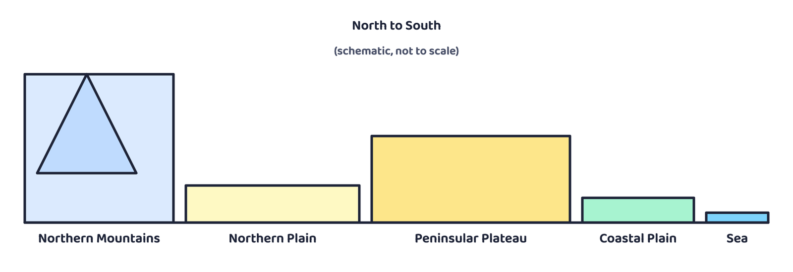
India’s land shows huge variety. The north has a wide belt of rugged land with mountain ranges, sharp peaks, beautiful valleys and deep gorges. The south is a stable tableland with highly dissected plateaus, worn-down rocks and rows of scarps. In between the two lies the vast Northern Plain.
Based on these broad differences, India is divided into six physiographic divisions:
3The Northern and North-Eastern Mountains
This division has two parts: the Himalayas, and the Northeastern hills. The Himalayas are not a single ridge, they are a series of parallel ranges.
| Himalayan range | Also called | Notes |
|---|---|---|
| Greater Himalaya | Himadri, the central axial range | The highest, continuous range; about 2,500 km long (east-west), 160-400 km wide (north-south) |
| Trans-Himalaya | Karakoram, Zaskar, Ladakh ranges lie in this belt | North of the Greater Himalaya, in the rain shadow, holds India’s cold desert |
| Middle Himalaya | Himachal | Lower, more broken ranges between the Greater Himalaya and the Shiwalik |
| Shiwalik | Outer Himalaya | The youngest, southernmost and lowest range, facing the plains |
- Direction changes along the length of the Himalayas: northwest to southeast in the northwestern part of India, east-west in the Darjiling and Sikkim region, southwest to northwest in Arunachal Pradesh, and north-south in Nagaland, Manipur and Mizoram.
- Standing almost like a long, strong wall, the Himalayas separate the Indian subcontinent from Central and East Asia. They are not just a physical barrier, they are also a climatic, drainage and cultural divide.
“Name the four Himalayan ranges from north to south” is a favourite one-mark question. Learn the order: Trans-Himalaya, Greater Himalaya, Middle Himalaya, Shiwalik (north to south) or the reverse (south to north) if the question asks that way.
4The Northern Plains
- Formed by alluvium (silt) brought down by the Indus, the Ganga and the Brahmaputra.
- Stretches about 3,200 km from east to west, with a width of 150-300 km. Alluvium depth reaches 1,000-2,000 m at its deepest.
- Haryana and Delhi form the water divide between the Indus and the Ganga river systems.
- The Brahmaputra flows northeast to southwest before turning almost 90° south at Dhubri, just before entering Bangladesh.
- The soil is fertile alluvium, so this belt grows wheat, rice, sugarcane and jute, and supports a very large population.
| Zone (north to south) | Width | What it is like |
|---|---|---|
| Bhabar | 8-10 km | Narrow belt right at the Shiwalik foothills; streams drop their pebbles and boulders here and often sink underground |
| Tarai | 10-20 km | South of the Bhabar; the streams re-emerge here with no fixed channel, making it marshy and swampy, with thick natural vegetation and varied wildlife |
| Bhangar | – | Old alluvium south of the Tarai; the higher, older part of the alluvial plain |
| Khadar | – | New alluvium, laid down closer to present-day rivers; renewed almost every year by floods |
- The mature stage of the rivers here has created landforms like sand bars, meanders, ox-bow lakes and braided channels. The Brahmaputra plains are known for their river islands and sand bars, and are subject to periodic floods.
- These mighty rivers also build some of the world’s largest deltas at their mouths, the Sunderbans delta being the best-known example. Away from the delta, this is otherwise a nearly featureless plain, at a general elevation of 50-150 m above mean sea level.
“Difference between Bhangar and Khadar” is asked almost every year. One line each is enough: Bhangar is old alluvium and lies higher; Khadar is new alluvium, lies lower and closer to the river, and gets renewed by floods.
5The Peninsular Plateau
- Rises from about 150 m (near the river plains) up to 600-900 m, in an irregular triangle.
- Its outer boundary runs from the Delhi ridge (northwest, an extension of the Aravalis) to the Rajmahal hills (east), the Gir range (west) and the Cardamom hills (south), with a further extension northeast into the Shillong and Karbi-Anglong plateau.
- It is made of a series of flat-topped (“patland”) plateaus: Hazaribagh, Palamu, Ranchi, Malwa, Coimbatore and Karnataka plateaus among them.
- It is one of the oldest and most stable landmasses of India. Elevation generally falls from west to east, which also matches the direction most of its rivers flow.
- Its landforms include tors, block mountains, rift valleys, spurs, bare rocky surfaces, hummocky hills and wall-like quartzite dykes that act as natural sites for storing water. Black soil dominates its western and northwestern part.
- It has gone through repeated phases of upliftment and submergence with crustal faulting, the Bhima fault being worth remembering for its repeated seismic activity. The northwestern part has a complex relief of ravines and gorges, the Chambal, Bhind and Morena ravines being the well-known examples.
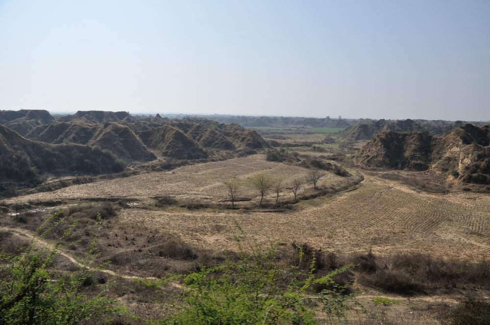
Based on relief, the Peninsular Plateau is grouped into three parts:
5.1 The Deccan Plateau
- Bounded by the Western Ghats (west), the Eastern Ghats (east) and the Satpura, Maikal range and Mahadeo hills (north).
- The Western Ghats have different local names: Sahyadri in Maharashtra, Nilgiri hills in Karnataka and Tamil Nadu, and Anaimalai and Cardamom hills in Kerala.
- Western Ghats are higher and more continuous than the Eastern Ghats, at an average elevation of about 1,500 m, rising from north to south. Most Peninsular rivers rise here.
- Eastern Ghats are discontinuous and low, and have been heavily eroded by rivers like the Mahanadi, the Godavari, the Krishna and the Kaveri. Their ranges include the Javadi hills, the Palconda range, the Nallamala hills and the Mahendragiri hills.
- The Eastern and Western Ghats meet at the Nilgiri hills.
Anaimudi, on the Anaimalai hills, is the highest peak of the entire Peninsular Plateau. Dodabetta, on the Nilgiri hills, is the second highest.
5.2 The Central Highlands
- Bounded on the west by the Aravali range. The Satpura range forms a series of scarped plateaus, 600-900 m high, and marks the Deccan Plateau’s northern boundary.
- A classic example of relict mountains: highly denuded and broken into discontinuous ranges. The extension reaches Jaisalmer in the west, covered there by longitudinal sand ridges and crescent-shaped dunes (barchans). Metamorphic rocks like marble, slate and gneiss confirm its long geological history.
- General elevation is 700-1,000 m, sloping towards the north and northeast. Most tributaries of the Yamuna rise in the Vindhyan and Kaimur ranges; the Banas, rising in the Aravalli, is the only significant tributary of the Chambal from the west.
- Its eastern extension is the Rajmahal hills, south of which lies the mineral-rich Chotanagpur plateau.
5.3 The Northeastern Plateau
- An extension of the main Peninsular plateau. A huge fault is believed to have formed between the Rajmahal hills and the Meghalaya plateau when the Indian Plate moved northeast during the Himalayan mountain-building, and the resulting depression was later filled by rivers.
- Today the Meghalaya and Karbi Anglong plateau stand detached from the main Peninsular Block. Meghalaya plateau is further divided into the Garo, Khasi and Jaintia Hills, named after the tribal groups who live there. There is a further extension into the Karbi Anglong hills of Assam.
- Like Chotanagpur, this plateau is rich in coal, iron ore, sillimanite, limestone and uranium. It receives the maximum rainfall from the southwest monsoon, which has left it highly eroded, Cherrapunji shows a bare rocky surface with almost no permanent vegetation.
6The Indian Desert, Coastal Plains and Islands
6.1 The Indian Desert
- Lies northwest of the Aravali hills, also called Marusthali.
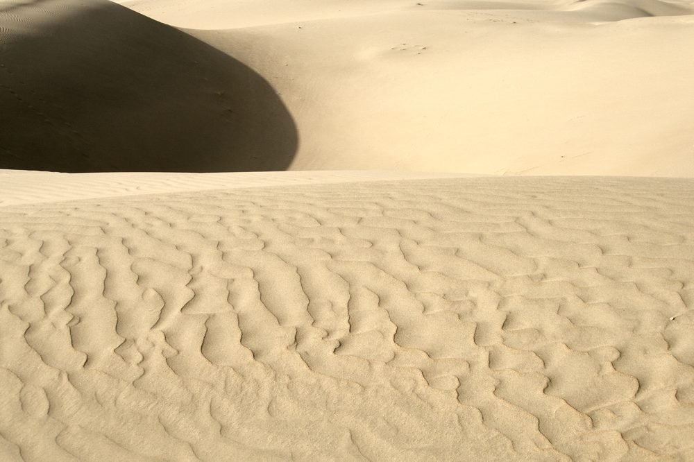
- Undulating land dotted with longitudinal dunes and barchans, and gets less than 150 mm of rainfall a year, giving it an arid climate and thin vegetation.
- During the Mesozoic era this region was under the sea, evidence for this comes from the wood-fossil park at Aakal (fossils about 180 million years old) and marine deposits near Brahmsar, close to Jaisalmer.
- Although the rock underneath is an extension of the Peninsular Plateau, extreme aridity has carved its own surface features here: mushroom rocks, shifting dunes and oases (mostly in the south).
- By slope, it is split into a northern part sloping towards Sindh and a southern part sloping towards the Rann of Kachchh.
- Most rivers here are ephemeral (short-lived, seasonal); the Luni river in the south is the significant exception. Low rainfall and high evaporation make it a water-deficit region. Some streams simply disappear into a lake or a playa (an example of inland drainage), and these playa lakes hold brackish water that is used to make salt.
A barchan is a crescent (moon)-shaped sand dune, formed by wind blowing steadily from one direction, with its horns pointing away from the wind.
A playa is a shallow, temporary desert lake that holds salty (brackish) water, left behind when an inland stream has no outlet to the sea.
6.2 The Coastal Plains
India’s long coastline is split into two, on the basis of location and how active the coastal processes are.
Western Coastal Plain
- A submerged coast, the mythical city of Dwaraka is believed to lie under the sea here
- Narrow, so it offers natural harbours: Kandla, Mazagaon, JLN Port Nava Sheva, Marmagao, Mangalore, Cochin
- Divisions (north to south): Kachchh and Kathiawar coast, Konkan coast, Goan coast, Malabar coast
- Narrow in the middle, wider in the north and south; rivers form no deltas here
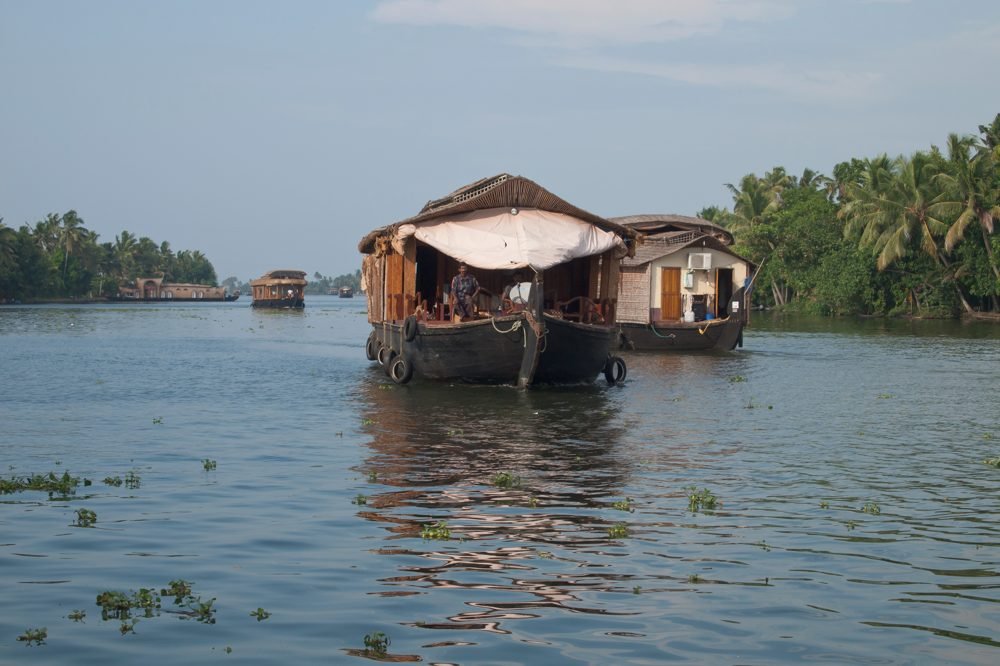
- Malabar coast has “Kayals” (backwaters), used for fishing, inland navigation and tourism
Eastern Coastal Plain
- An emergent coast, so it is broader than the western plain
- Well-developed deltas of the Mahanadi, the Godavari, the Krishna and the Kaveri
- Fewer natural ports and harbours because the coast is emergent
- Continental shelf extends up to 500 km into the sea
- No local backwater system comparable to the Kayals
A Kayal is a shallow, lagoon-like backwater found along the Malabar coast of Kerala, connected to the sea and used for fishing, inland boat traffic and tourism. Every year, Kerala’s famous Nehru Trophy Vallamkali boat race is held on the Punnamada Kayal.
The continental shelf is the shallow, gently sloping seabed that surrounds a landmass before the ocean floor drops away steeply.
On 26 December 2004, the Andaman and Nicobar Islands were struck by one of the most destructive natural disasters India has faced, the Indian Ocean tsunami. It also badly affected the coasts of Tamil Nadu, Andhra Pradesh, Kerala and Puducherry.
6.3 The Islands
India has two major island groups, one in the Bay of Bengal and one in the Arabian Sea.
| Bay of Bengal (Andaman & Nicobar) | Arabian Sea (Lakshadweep & Minicoy) | |
|---|---|---|
| Number | About 572 islands and islets | About 36 islands, 11 of them inhabited |
| Location | 6°N-14°N, 92°E-94°E | 8°N-12°N, 71°E-74°E; 220-440 km off the Kerala coast |
| Origin | Believed to be elevated tops of submarine mountains; a few smaller ones are volcanic | Entirely built of coral deposits |
| Internal split | Andaman (north) and Nicobar (south), separated by the Ten Degree Channel | Amini Island (north) and Cannanore Island (south), separated by the Nine Degree Channel |
| Special feature | Barren Island: India’s only active volcano | Minicoy: the largest island, 453 sq km |
| Climate | Convectional rainfall, equatorial vegetation, coral deposits and beaches | Storm beaches of pebbles, shingles, cobbles and boulders on the eastern side |
- Andaman and Nicobar’s two main sub-groups are the Ritchie’s archipelago and the Labrynth island.
- Important peaks: Saddle Peak (North Andaman, 738 m), Mount Diavolo (Middle Andaman, 515 m), Mount Koyob (South Andaman, 460 m) and Mount Thuiller (Great Nicobar, 642 m).
Structure decides what the land is made of; physiography decides what shape that land finally takes, mountain, plain, plateau, desert, coast or island.
the one idea to carry out of this chapter
- India has three geological divisions: the rigid Peninsular Block, the young Himalaya and Peninsular Mountains, and the still-filling Indo-Ganga-Brahmaputra Plain.
- Physiography is the shape structure finally takes: six divisions, Northern and North-Eastern Mountains, Northern Plain, Peninsular Plateau, Indian Desert, Coastal Plains, Islands.
- The Himalayas have four ranges, Trans-Himalaya, Greater Himalaya, Middle Himalaya and Shiwalik, and act as a physical, climatic, drainage and cultural divide.
- The Northern Plain runs Bhabar to Tarai to Bhangar/Khadar, north to south, and is India’s most fertile, most populated belt.
- The Peninsular Plateau is India’s oldest landmass, split into the Deccan Plateau, the Central Highlands and the Northeastern Plateau.
- Anaimudi (2,695 m) is the highest peak of the Peninsular Plateau; Barren Island is India’s only active volcano.
- The western coast is submerged and narrow with no deltas; the eastern coast is emergent, broader, and has well-developed deltas.
- India’s two island groups are the Bay of Bengal group (elevated submarine mountains, some volcanic) and the Arabian Sea group (entirely coral).
- 1 markWhich water body separates the Andaman Islands from the Nicobar Islands?
(a) 11° Channel(b) Gulf of Mannar(c) 10° Channel(d) Andaman Sea - 1 markThe ‘Dodabetta’ peak is situated on which hill range?
(a) Nilgiri hills(b) Anaimalai hills(c) Cardamom hills(d) Nallamala hills - 1 markWhat is the highest peak of the Peninsular Plateau?
(a) Dodabetta(b) Anaimudi(c) Mahendragiri(d) Kalsubai - 1 markThe Bhabar belt lies parallel to the foothills of which range?
(a) Vindhyan Range(b) Aravali Range(c) Satpura Range(d) Shiwalik Range - 1 markWhich fault separates the Meghalaya-Karbi Anglong plateau from the Chotanagpur plateau area?
(a) Malda fault(b) Bhima fault(c) Narmada fault(d) Son fault - 1 markBarren Island, India’s only active volcano, lies in which island group?
(a) Lakshadweep(b) Andaman and Nicobar Islands(c) Gulf of Kachchh(d) Gulf of Mannar - 1 markThe Northern Plains stretch approximately how far from east to west?
(a) 2,500 km(b) 1,500 km(c) 4,000 km(d) 3,200 km - 1 markWhich of these is old alluvium in the Northern Plains?
(a) Khadar(b) Bhabar(c) Bhangar(d) Tarai
- 1 mark
Assertion (A): The Peninsular Block is one of the most stable landmasses of India.
Reason (R): The Peninsular Block has remained a rigid landmass since the Cambrian period, with only its western coast submerged and a few parts changed by tectonic activity. - 1 mark
Assertion (A): The Indian Desert receives very low annual rainfall, mostly below 150 mm.
Reason (R): The Indian Desert lies to the northwest of the Aravali hills. - 1 mark
Assertion (A): The Andaman Islands and the Nicobar Islands are separated by the Ten Degree Channel.
Reason (R): Every island in the Andaman and Nicobar group was formed only by volcanic activity. - 1 mark
Assertion (A): The eastern coastal plain of India has more natural ports and harbours than the western coastal plain.
Reason (R): An emergent coast has a wide, gently sloping continental shelf, which makes deep-water port development difficult.
- 1 markDefine physiography.
- 1 markName the three geological divisions of India.
- 1 markAt which hill range do the Eastern and Western Ghats meet?
- 1 markName India’s only active volcano and the island group in which it lies.
- 1 markWhat is Marusthali?
- 1 markName the channel that separates the Andaman Islands from the Nicobar Islands.
- 3 marksIf a person is to travel to Lakshadweep, from which coastal plain would he prefer to travel, and why?
- 3 marksWhere in India will you find a cold desert? Name some important ranges of this region.
- 3 marksWhy is the western coastal plain devoid of any delta?
- 3 marksWhat is the difference between Bhangar and Khadar?
- 3 marksName any four physiographic features found in the northwestern part of the Peninsular Plateau.
- 3 marksWhy is the Meghalaya Plateau said to be highly eroded?
- 3 marksWhat is a Kayal? Name one activity for which it is used.
- 5 marksMake a comparison of the island groups of the Arabian Sea and the Bay of Bengal.
- 5 marksWhat are the important geomorphological features found in the river valley plains of the Northern Plains?
- 5 marksIf you move from Badrinath to the Sunderbans delta along the course of the river Ganga, what major geomorphological features will you come across?
- 5 marksDescribe the three broad divisions of the Peninsular Plateau along with their key features.
- 5 marksExplain why the Peninsular Block is considered geologically more stable than the Himalayas.
- 5 marksDescribe the western and eastern coastal plains of India, bringing out the differences between them.
- Can I name all three geological divisions and all six physiographic divisions, in order, without looking?
- Can I list the four Himalayan ranges from north to south?
- Can I explain the difference between Bhabar, Tarai, Bhangar and Khadar?
- Can I explain why the western coast has no deltas but the eastern coast does?
- Can I compare the two island groups on origin, number and location?