Before you can study India’s climate, rivers or people, you need to know exactly where India sits on the globe. This chapter answers one question: what does India’s location actually do to the country? Every fact below exists to answer that, not just to be memorised on its own.
1Location and Extent
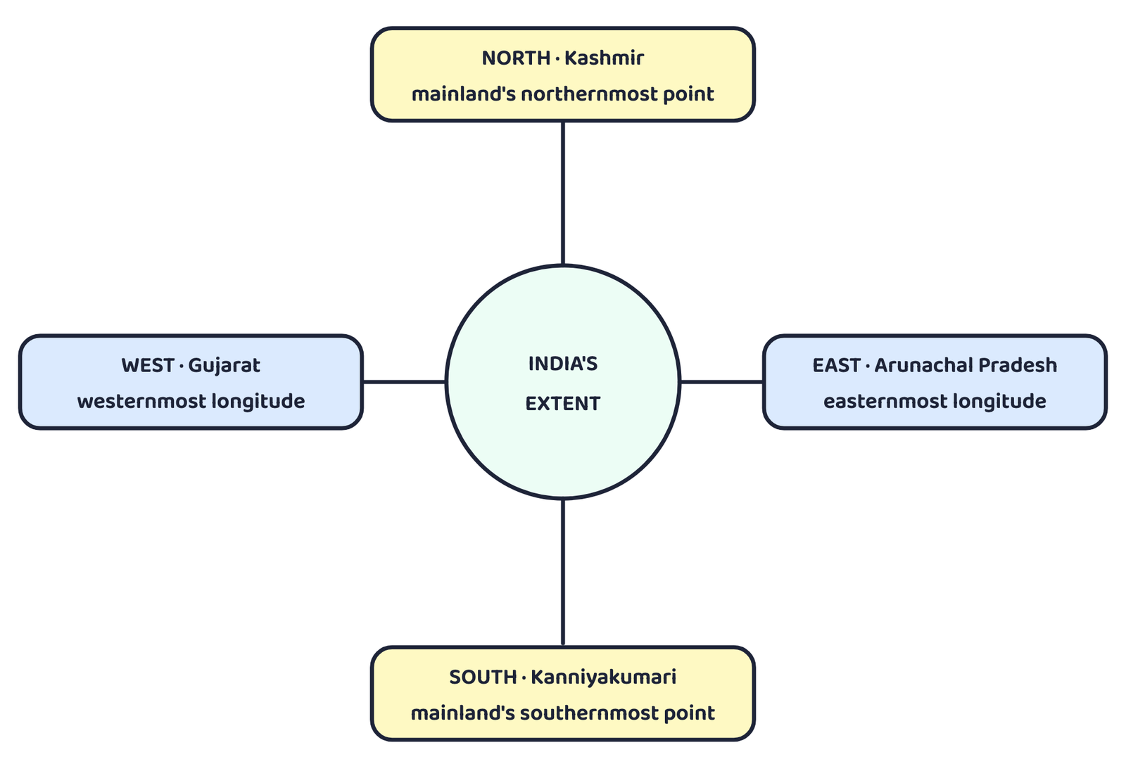
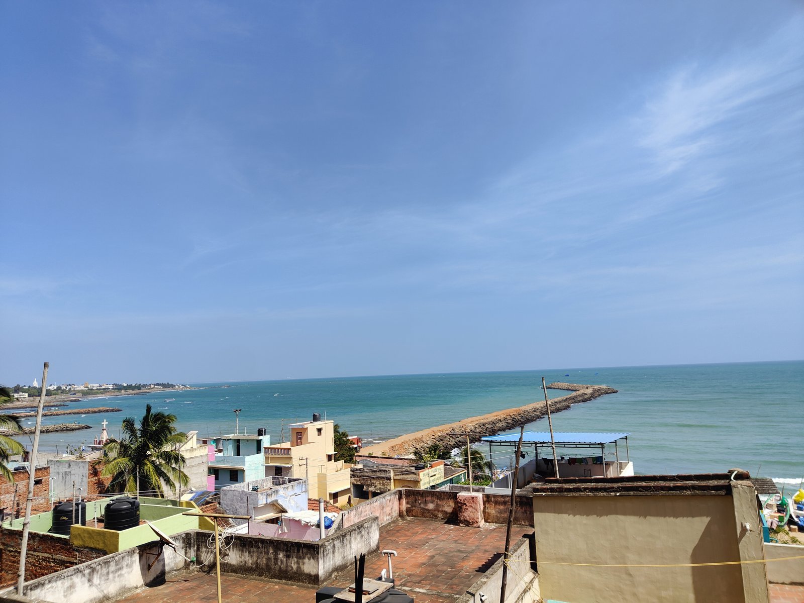
India’s mainland stretches from Kashmir in the north to Kanniyakumari in the south, and from Arunachal Pradesh in the east to Gujarat in the west. That is not the end of India’s territory, though. A country’s territorial limit extends into the sea too.
India’s territorial limit extends 12 nautical miles (about 21.9 km) into the sea from the coast.
The mainland’s own southernmost and northernmost latitudes are what the exercise at the end of this chapter asks about. But India’s southern boundary, including its islands, goes further still: it extends up to 6°45’N latitude in the Bay of Bengal.
2Latitudinal and Longitudinal Extent: Why It Matters
India’s latitudinal and longitudinal extent are both roughly 30°. But the actual ground distance is not the same in both directions: north to south it is 3,214 km, while east to west it is only 2,933 km.
This “why are the two distances different despite an equal degree-spread” question is asked almost every year. Give the reason, not just the numbers.
This large latitudinal spread also decides India’s climate zones. The southern part of the country lies within the tropics; the northern part lies in the sub-tropical or warm temperate zone. This single fact is the reason India shows such large variation in land forms, climate, soil types and natural vegetation from south to north.
The longitudinal spread of about 30° causes a time difference of nearly 2 hours between India’s easternmost and westernmost parts. Yet the whole country runs on one clock.
A standard meridian is the line of longitude a country picks as the basis for its one official clock time, so that everyone in the country can agree on the same time regardless of where the sun actually is overhead.
A country with a very large east-west spread may need more than one standard meridian. The book’s own example:
This is why sunrise happens about two hours earlier in India’s northeastern states than at Jaisalmer, and yet a watch in Dibrugarh or Imphal shows exactly the same time as a watch in Jaisalmer, Bhopal or Chennai. Every one of them is set to the single standard meridian at 82°30’E, not to the local sun.
3Size of India
A country this large cannot look the same everywhere, and India does not. Its size alone has given it enormous physical diversity:
Lofty mountains
In the north of the country.
Large rivers
Ganga, Brahmaputra, Mahanadi, Krishna, Godavari and Kaveri.
Forested hills
Green, forested hill country in the northeast and in south India.
Desert
The vast sandy expanse of Marusthali.
4The Indian Subcontinent
The Indian subcontinent is the great geographic entity bounded by the Himalayas in the north, the Hindukush and Sulaiman ranges in the northwest, the Purvachal hills in the northeast, and the vast expanse of the Indian Ocean in the south.
| Countries inside the Indian subcontinent |
|---|
| India, Pakistan, Nepal, Bhutan, Bangladesh |
In the past, the Himalayas, together with the other ranges around them, acted as a formidable physical barrier. Crossing them was difficult except through a few mountain passes:
This barrier is exactly what let the Indian subcontinent develop its own unique regional identity, cut off enough from the rest of Asia to grow differently, yet never completely sealed off.
5Coastline
India’s peninsular part reaches out into the Indian Ocean, and that gives the country a long coastline.
The extra length comes from two island groups: the Andaman and Nicobar Islands in the Bay of Bengal, and the Lakshadweep islands in the Arabian Sea. Because of this coastline and these islands, India is a physically diverse land that gives it access to varied resources.
6India and Its Neighbours
Look at India’s place on the map of Asia and one thing stands out: India sits in the south-central part of the continent of Asia, bordering the Indian Ocean. Two arms of that ocean reach up on either side of the country: the Bay of Bengal in the east and the Arabian Sea in the west.
This maritime location matters in a very practical way: Peninsular India’s position on the sea has given it links to its neighbouring regions by both sea and air routes.
| Type | Neighbours |
|---|---|
| Land neighbours named in this chapter’s own exercise | Bangladesh, China, Pakistan, Myanmar |
| Land neighbours that make up the Indian subcontinent | Pakistan, Nepal, Bhutan, Bangladesh |
| Island-country neighbours in the Indian Ocean | Sri Lanka, Maldives |
Sri Lanka is separated from India by the Gulf of Mannar and the Palk Strait.
Gulf
- A large part of the sea that pushes into the land
- Usually wider, more open towards the ocean
- Example: Gulf of Mannar
Strait
- A narrow channel of water joining two larger seas
- Separates two pieces of land from each other
- Example: Palk Strait, between India and Sri Lanka
The book itself asks: “is physical distance still a hindrance to interaction with neighbours today?” The expected answer is no, not as much as before: modern sea routes, air travel, telecommunications and trade agreements have reduced the friction that physical distance used to cause, even though the distance itself has not changed.
School Bhuvan NCERT is a web portal that gives map-based learning about India’s natural resources, environment and sustainable development. It is an initiative of Bhuvan-NRSC/ISRO, built on the NCERT syllabus.
- Mainland: Kashmir to Kanniyakumari, Arunachal Pradesh to Gujarat; territorial limit 12 nautical miles into the sea
- Latitude and longitude both span ~30°, but N-S distance (3,214 km) is more than E-W distance (2,933 km) because meridians converge towards the poles while parallels stay evenly spaced
- Southern India lies in the tropics, northern India in the sub-tropics. This drives the country’s variety in climate, soil and vegetation
- Standard meridian: 82°30’E; IST = GMT + 5:30; one time zone for the whole country despite a ~2-hour sunrise gap
- Area: 3.28 million sq km, 2.4% of world land, 7th largest country
- Indian subcontinent = India, Pakistan, Nepal, Bhutan, Bangladesh, ringed by the Himalayas, Hindukush-Sulaiman ranges and Purvachal hills
- Coastline: 6,100 km mainland, 7,517 km with Andaman & Nicobar and Lakshadweep included
- India borders the Indian Ocean’s two arms, Bay of Bengal and Arabian Sea; Sri Lanka and Maldives are its island neighbours
- 1 markName the strait that separates Sri Lanka from India.
- 1 markWhat is India’s standard meridian?
- 1 markName the two island groups that add to India’s coastline.
- 1 markWhat is India’s rank in the world by area?
- 1 markName any two of the five mountain passes through which the Himalayas were historically crossed.
- 2 marksDefine territorial limit, with the figure given for India.
- 2 marksName the two arms of the Indian Ocean that border India, and say which side of the country each one is on.
- 2 marksWhat convention do countries follow while choosing a standard meridian?
- 3 marksDoes India need to have more than one standard time? Give your reasoned answer.
- 3 marksWhat are the implications of India having a long coastline?
- 3 marksHow is the latitudinal spread of India advantageous to her?
- 3 marksWhile the sun rises earlier in the east, say in Nagaland, and also sets earlier, how do the watches at Kohima and New Delhi show the same time?
- 5 marksIndia’s latitudinal and longitudinal extent are both about 30°, yet the north-south distance and the east-west distance are different. Explain why, and state both distances.
- 5 marksDescribe the Indian subcontinent: the ranges that bound it, the countries inside it, and the historical role of the Himalayas as a physical barrier.
- 5 marksExplain how India’s size and its maritime location together have shaped its physical diversity and its links with neighbouring regions.
- 1 markWhich one of the following latitudinal extents is relevant for the extent of India’s area?
(a) 8°41’N – 35°7’N(b) 8°4’N – 37°6’N
(c) 8°4’N – 35°6’N(d) 6°45’N – 37°6’N - 1 markWhich one of the following countries shares the longest land frontier with India?
(a) Bangladesh(b) China
(c) Pakistan(d) Myanmar - 1 markWhich one of the following countries is larger in area than India?
(a) China(b) Egypt
(c) France(d) Iran - 1 markWhich one of the following longitudes is the standard meridian for India?
(a) 69°30’E(b) 82°30’E
(c) 75°30’E(d) 90°30’E - 1 markIndia’s territorial limit extends into the sea up to:
(a) 6 nautical miles(b) 12 nautical miles
(c) 200 nautical miles(d) 82 nautical miles - 1 markSri Lanka is separated from India by the Palk Strait and:
(a) Gulf of Mannar(b) Gulf of Kutch
(c) Gulf of Khambhat(d) Ten Degree Channel
Reason (R): The distance between two meridians of longitude decreases towards the poles, while the distance between two parallels of latitude stays the same everywhere.
Reason (R): India’s longitudinal extent causes no time difference at all between its easternmost and westernmost parts.
- 1 markIndia’s territorial limit extends _______ nautical miles into the sea from the coast.
- 1 markThe Lakshadweep islands lie in the _______ Sea.
- 1 markIndia’s southern boundary, including its islands, extends up to _______ N latitude in the Bay of Bengal.
- 1 markIndia’s coastline including the islands is _______ km long.
- 1 markThe Indian subcontinent is bounded on the northeast by the _______ hills.